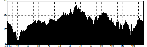
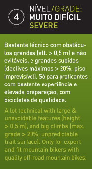
This route follows the same course as the red route as far as Enxoé brook. It is a very long and difficult route that runs the length of the county to arrive at a series of mountains: the Serras de Malpique, Adiça e Ficalho. This route can be made shorter by following the connection available for GPS.
Distância
124 km
Duração
8h15
Tipo de percurso
circular
Desnível
+1470 m
Gráfico